Structural Rock Imaging and Shear Zone Detection
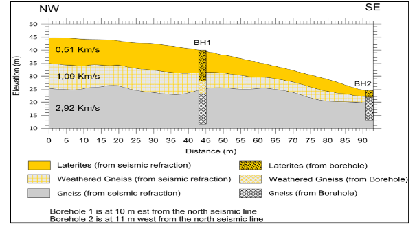
Refraction
Commonly used for Bedrock mapping and water table surface. Compressional wave velocities of soil and rock (Vp).
Refraction was at one time the heart of the engineering applications because the most important element was bedrock mapping. Now it is done to accompany other techniques.
Resonance Imaging
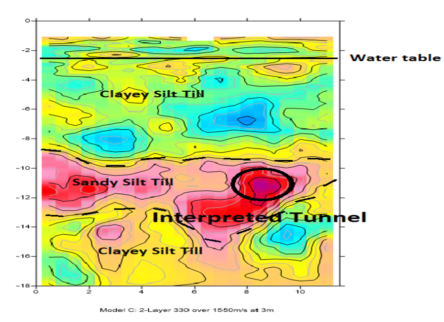
Detailed Geologic Images of soil and rock up to 100meters depth, including voids.
Ambient Noise Surface Wave Tomography
Advanced passive seismic technique to model shear strength of soils, rock, overburden structures and rock structures in 3D.
Large HVSR arrays over extended periods of recording will generate detailed 2D and 3D images for overburden down to bedrock by discriminating their shear-wave velocities.