Overburden Geologic Mapping
Refraction
Commonly used for Bedrock mapping and water table surface. Compressional wave velocities of soil and rock (Vp).
Refraction was at one time the heart of the engineering applications because the most important element was bedrock mapping. Now it is done to accompany other techniques.
Reflection
Geologic Images of soil and rock below 50 meters depth.
MASW / Remi
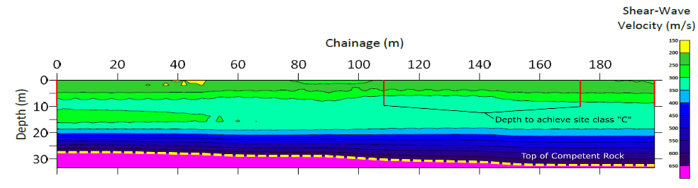
Measuring shear wave velocities of soils (Vs) and rock surface, determines seismic site class (Vs30).
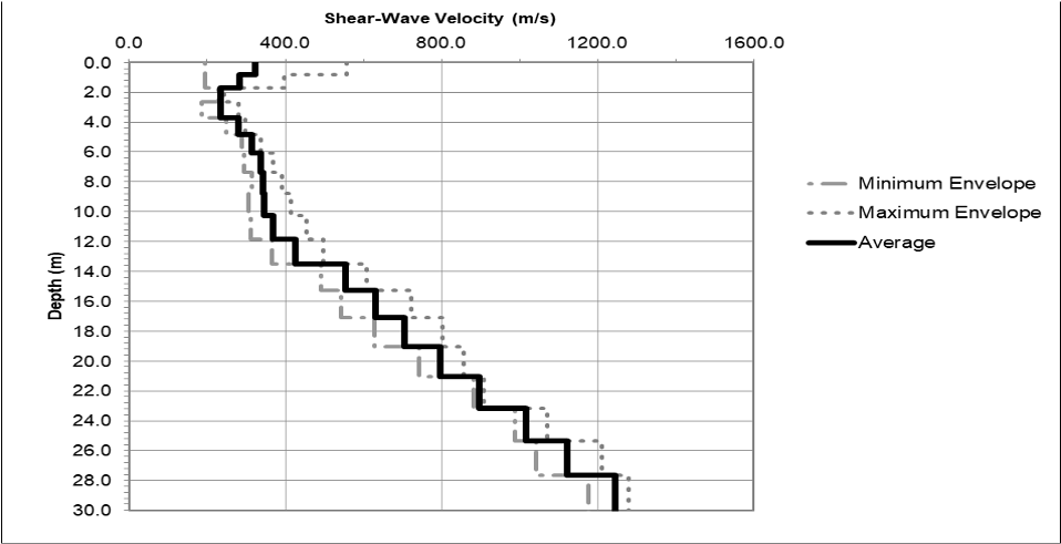
MASW Results: shear-wave velocities with depth
1-D sounding for seismic site class or 2-D profile which is becoming more common for retaining walls and shoring walls or general mapping of bedrock.
Resonance Imaging
Detailed Geologic Images of soil and rock up to 100meters depth, including voids.